

New Bomb Site Map Shows The Locations Of Bombs Dropped On London During The Blitz
It’s unlikely that many of the current residents of London think too much about the Blitz and the amount of bombs that were dropped on the capital or the humongous impact that they had on changing the entire geography of the area, but a new site called the Bomb Sight Map will now enable you to reconnect with history and do just that.”
The map pinpoints where each bomb fell between 7 October 1940, and 6 June 1941 during the Blitz. In this period, 43,000 civilians were killed after over 30,000 bombs were dropped in London. The onslaught only slowed down when Hitler turned his attention and resources to invading Russia instead.
Featured Image VIA
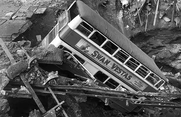
Image VIA
On the site you can search using street names, boroughs and postcodes to find out how many bombs affected your area, the area you specifically live or where your mates live. Maybe you can have some kind of dumb competition to see whose house managed to withstand more bombs.
There’s a timeline option so you can see how your chosen location was affected by bombs over time. You can also check how many bombs landed on the first night of the Blitz with the timeline option, which is a hell of a lot and really gives you an even greater insight into just how devastating an event this was.
Bomb Sight is available as an Android app (although it isn’t on iPhone for some reason) so you can use the GPS option to find out how many bombs were dropped exactly where you’re standing. Far out.
Maybe one day they’ll have a similar app for the live scorpion bombs that ISIS are allegedly dropping on Iraq at the moment.


