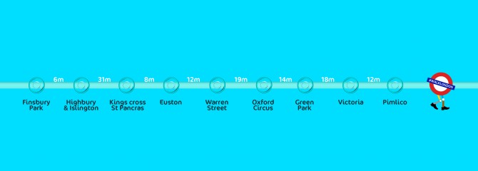
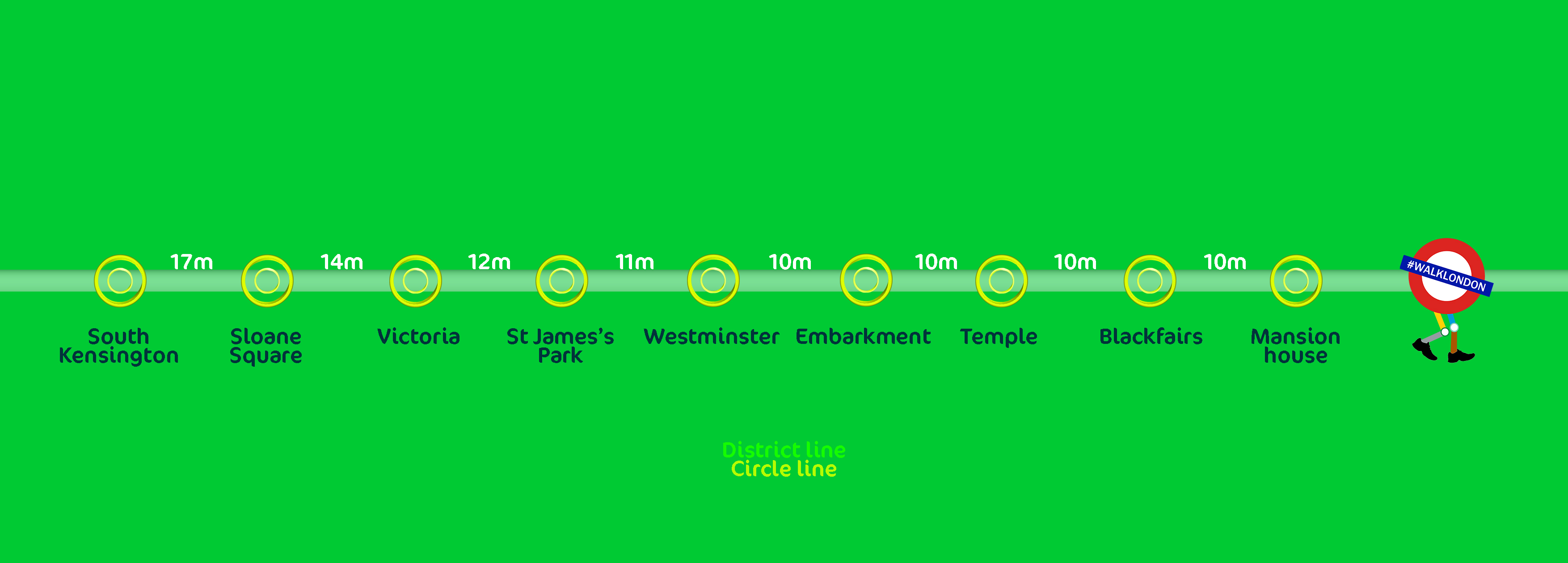
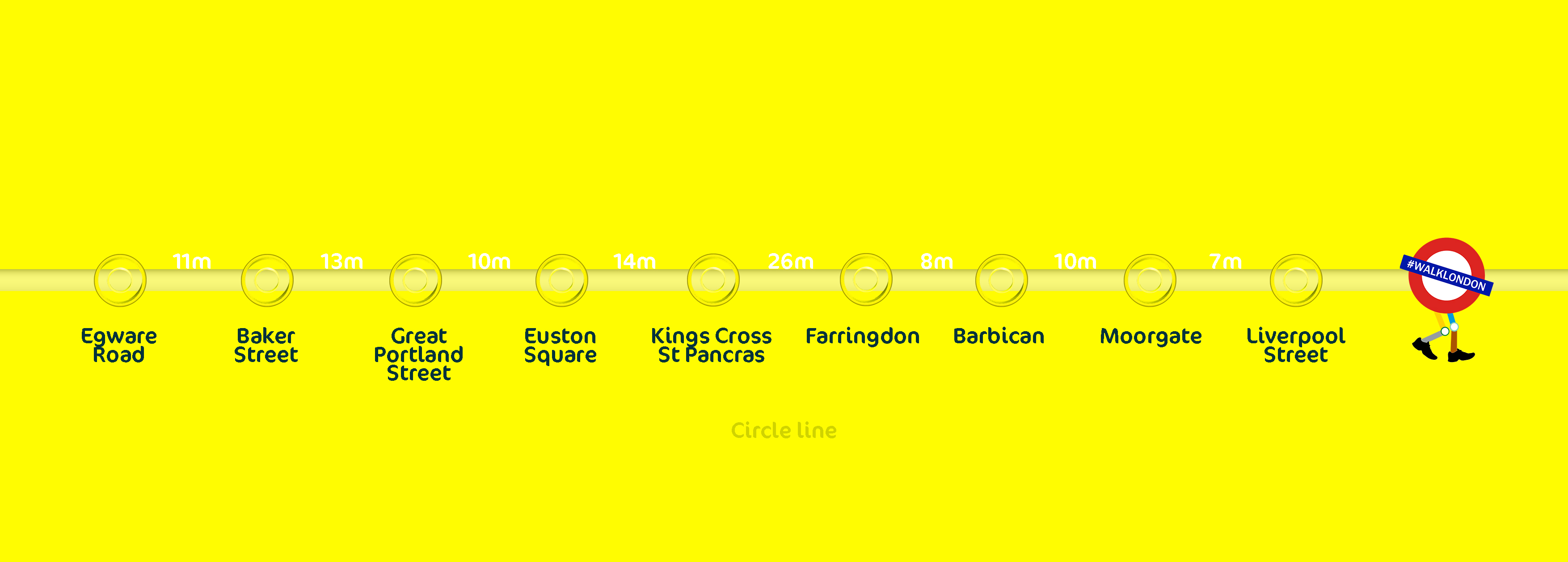
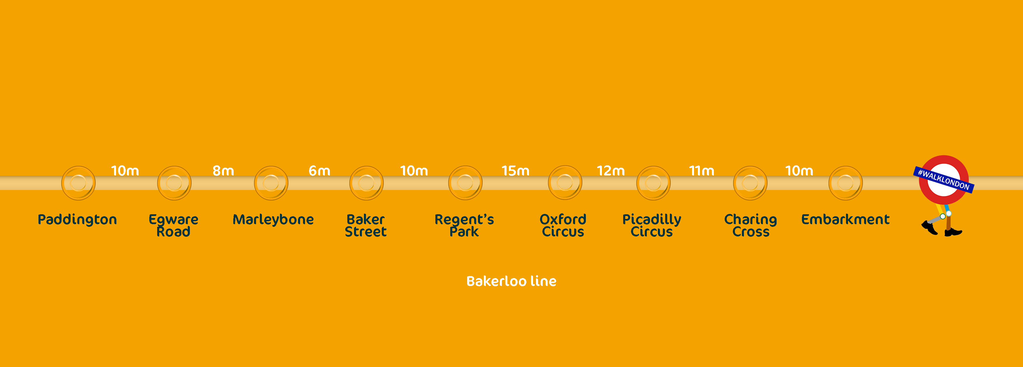
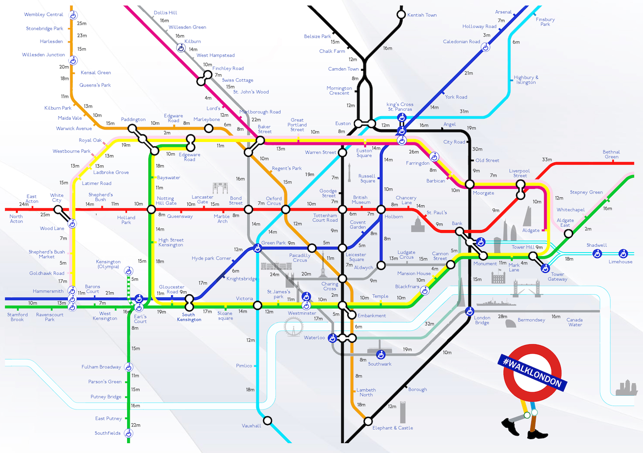
It’s funny because the other day I was talking to a buddy who doesn’t live in LDN who told me he always got really confused when he got the tube because he had no idea how far away any of the tube stations were from each other, and often ended up getting the tube for a minute when he could have just walked for five and ended up in the same place. He said he thought it would be a really good idea if there was a map or some kind of resource that highlighted this information.
No sooner had he said that then I get an email in my inbox from a creative art director named Aryven Arasen from aryjoecreatives.com who has created such a map, with the hopes of encouraging people to walk around London rather than getting the tube, especially during the recent tube strikes that have been pissing everyone off.
You can check out the maps below (click to enlarge) and feel free to print them out and use them yourself. Or just tell your friends as I’m sure you’ll have one who’s had the same problem as mine.
☛ More London Tubes: Prankster Puts Fake Hilarious Signs On The London Tube
☛ More London Tubes: London Tubes Set To Run 24 Hours At Weekends