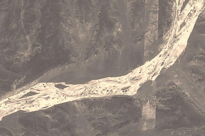
Some of the patterns have clearly been there for a while. Here’s a close up of a river bed cutting across one of the thick grid lines. Could it have been dinosaurs?… nah, sorry, too far.
Another possibility: some kind of firing range so that they can test the accuracy of their bombing i.e. can you hit the corner of this road and that road without blowing up that road. That maybe makes a bit more sense, but I can’t see any bomb craters? Another idea is that they are using the reflective looking strips below for some sort of radar profiling for planes. Somehow measuring the light bouncing off aircraft or something.
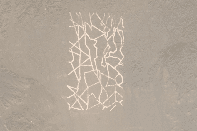
What are these even made out of? They kind of look reflective? This weird pattern in about 1 km x 2 km in size, i.e. not small.
The best answer I could find on my search was that the structures were used for satellite calibration. Apparently China has quite a few satellites whipping around up there and these odd shapes might help them maintain and check their positions.
However, Dwayne Day a military space historian who knows about such things says that these calibration markings are normally much smaller and simpler. He added: “There’s no reason why you would build anything that big for a satellite calibration target”. Dwayne also points out that there are no defensive fences around it so it can’t be strategically important, he says: “We don’t know what the heck it is, but there are probably two guys in China who could tell you what it is and you’d be bored silly.”
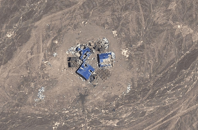
Here are some shed type structures that have been blown up, I think we can all agree that this place is a military base or testing range of some sort. But that still doesn’t answer the questions about the massive weird grid shizzle.
The Chinese government haven’t come forward and explained what the shapes are for. Why should they? America wouldn’t tell the Chinese anything, hell, they won’t even tell their own people what’s going on. And if China did one day come out and say “look, chill out guys, it’s just for calibrating satellites…” or whatever, all the conspiracy nut jobs would just scream “LIARS”. So, no, I don’t suppose we’ll have a definitive answer for quite some time.
These mysteries do often turn out to be pretty mundane, but I just can’t see how this time? It certainly kicks the crap out of Area 51.
If you want to have a look around the place yourself, here’s the coordinates Captain: 40°27’28.56″N, 93°23’34.42″E
☛ Next: The Most Famous Map Of The World Is Completely Inaccurate