

New Detailed Map Gives Us Most Amazing View Of Mars Yet
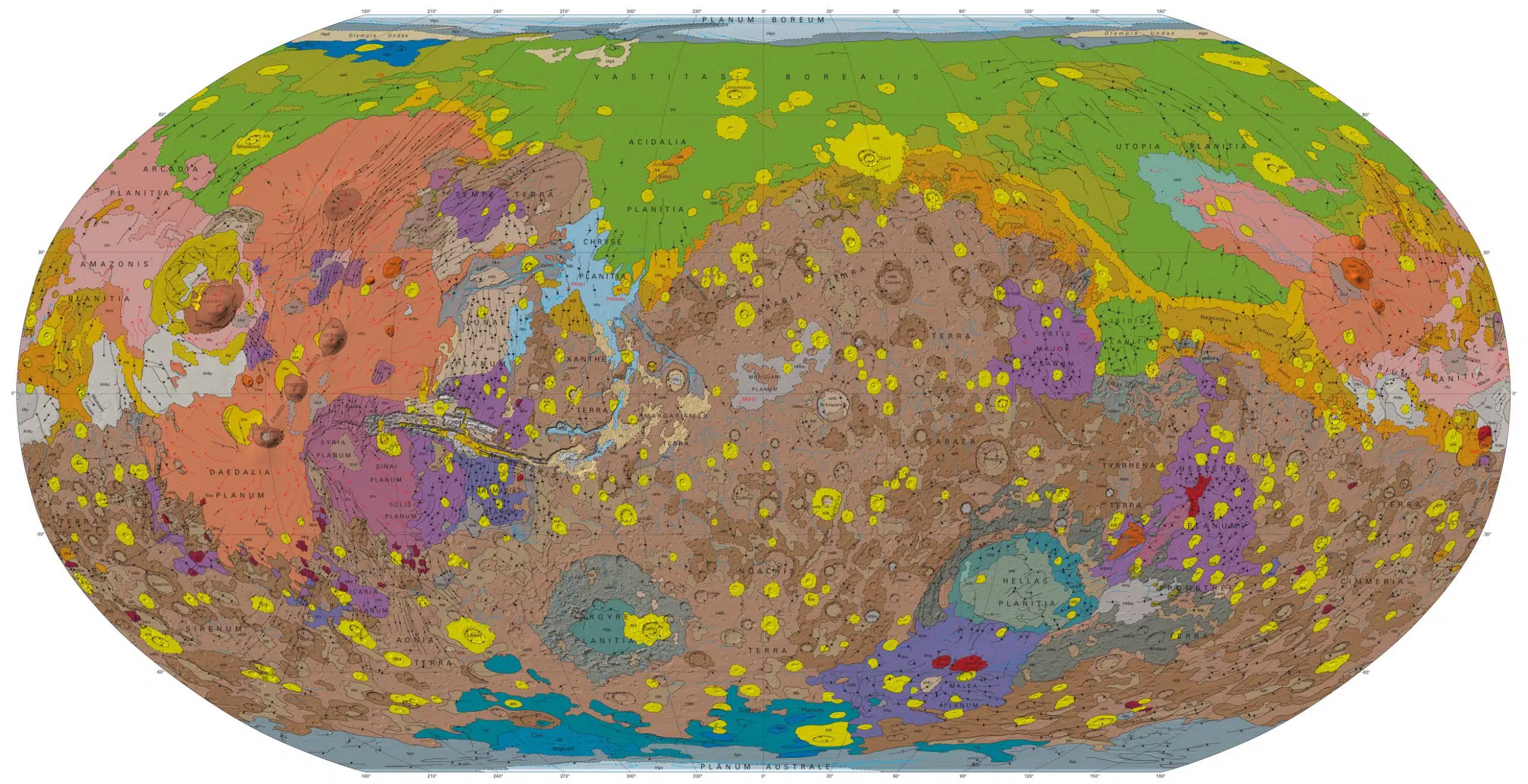
After 16 years of work in progress and the help of four orbiting spacecraft, the U.S. Geological Survey have finally released their newest map of Mars and it’s truly spectacular. Showing the Red Planet in more detail than ever before, the map reveals a new understanding of the planet’s past.
Mars is Earth’s most similar neighbor and the only other planet in our sun’s habitable zone (orbits at the right distance to be a livable temperature and sustain liquid water). Humans have been studying the surface of Mars with ground-based telescopes for around 400 years. But it was the Mariner 9 mission and the Viking Orbiter missions that gave us our first global views of Mars and led to the first complete geologic maps of Mars (in 1978 and 1986-87)–the first of any planetary surface beyond Earth and the moon.
The onslaught of up-close exploration in recent years has yielded a ton of information. The Mars Global Surveyor, Mars Odyssey,Mars Express and Mars Reconnaissance Orbiter missions have pored over the planet’s surface with a bunch of different sensors that can detect everything from the types of minerals present on the surface, to the amount of water vapor in the atmosphere, to the structure of the shallow subsurface. These orbiters showed that much of the planet’s surface is older than scientists thought. The area formed more than 4 billion years ago (the darkest brown on the map) is three times as large. The new map also backs up the idea that Mars was geologically active until recently, and that liquid water once was present on the surface.
(VIA Wired)
Check out the map below and click here for a high-resolution version.


